blah blah blah
Great Hill (Bow)
Length: 1.2 miles out-and-back with loopDifficulty (click for info): Beginner
Elevation Gain: 140 feet (+30 feet on descent)
Rating (click for info): 5/10
Elevation: 875'
Prominence: 153'
Driving Directions:
Trailhead is on South Bow Road in Bow, NH. From the end of the exit 11 ramp off I-93, turn right onto Hackett Hill Road and follow it 1.7 miles west. Turn right onto South Bow Road. 2.7 miles up the road, you will see the trailhead kiosk on the right at the top of a hill. You can park on the wide shoulder. Click here for a Google map.
Trail Map
About the Hike:
The town of Bow's Nottingcook Forest offers a nice forest getaway between Concord and Manchester. The conservation property has enough walking trails to enjoy a pleasant afternoon in the woods. The centerpiece of the network is Great Hill, a low rise that would not be notable for any reason if a vast swath of tree-clearing had not passed over its summit and opened up a wonderful panorama. The trails approach the hill on its gentle side, making for an effortless walk, while the view is cleared out over the steep side, allowing distant views. This hike describes a short loop around Great Hill itself, but further exploration can be fashioned by consulting the property's trail map.
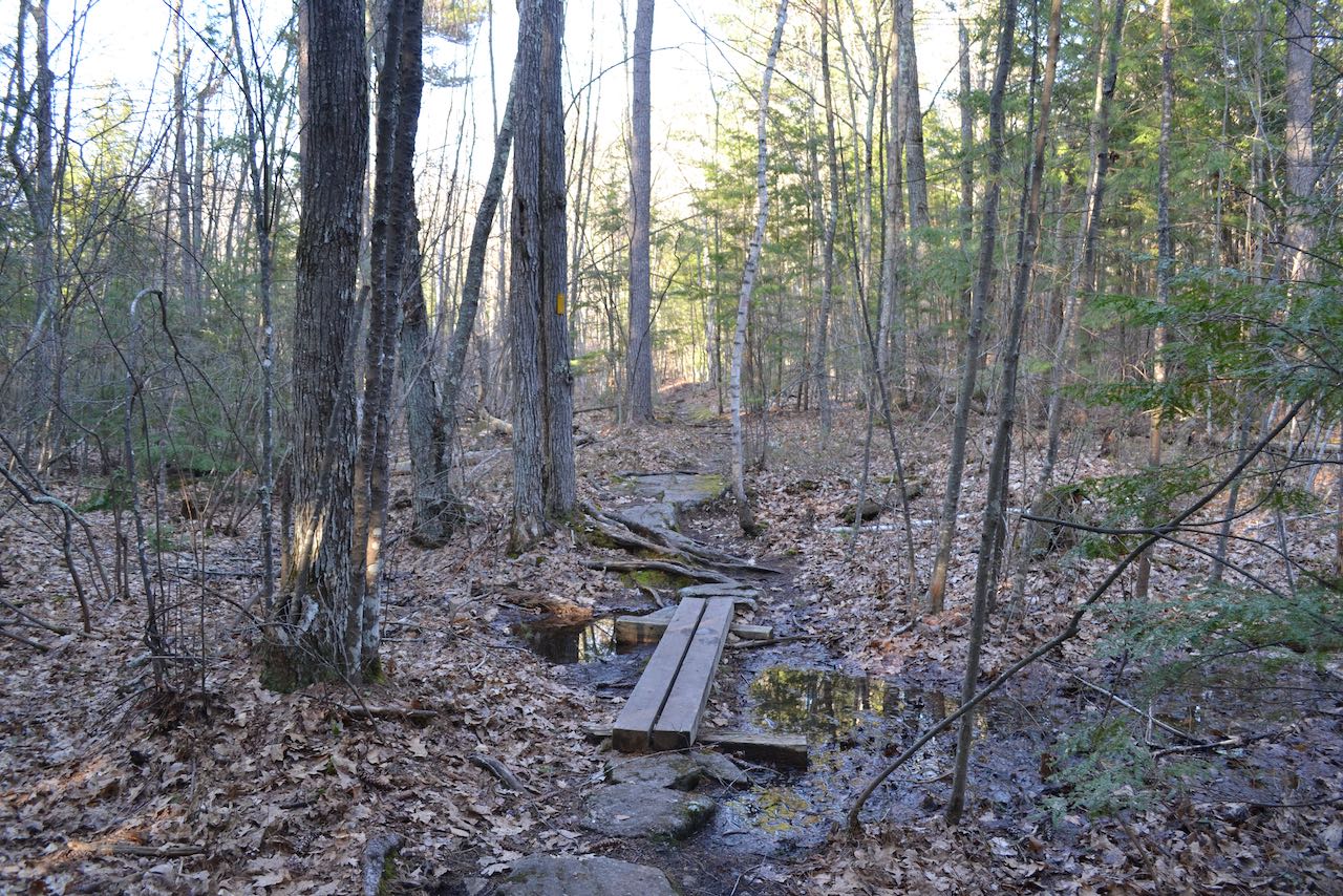
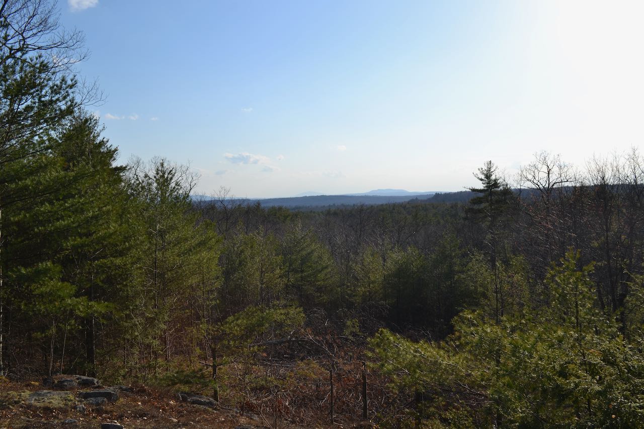
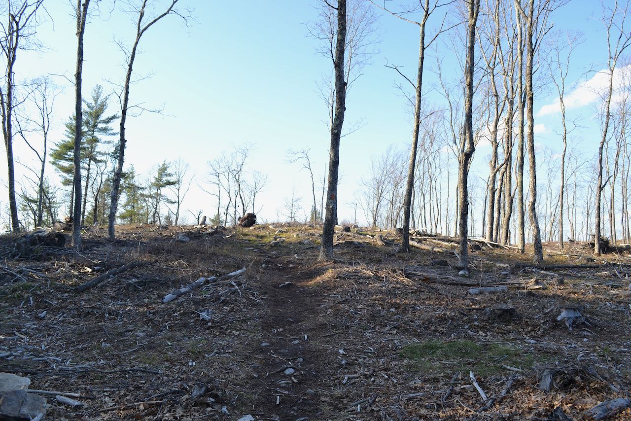
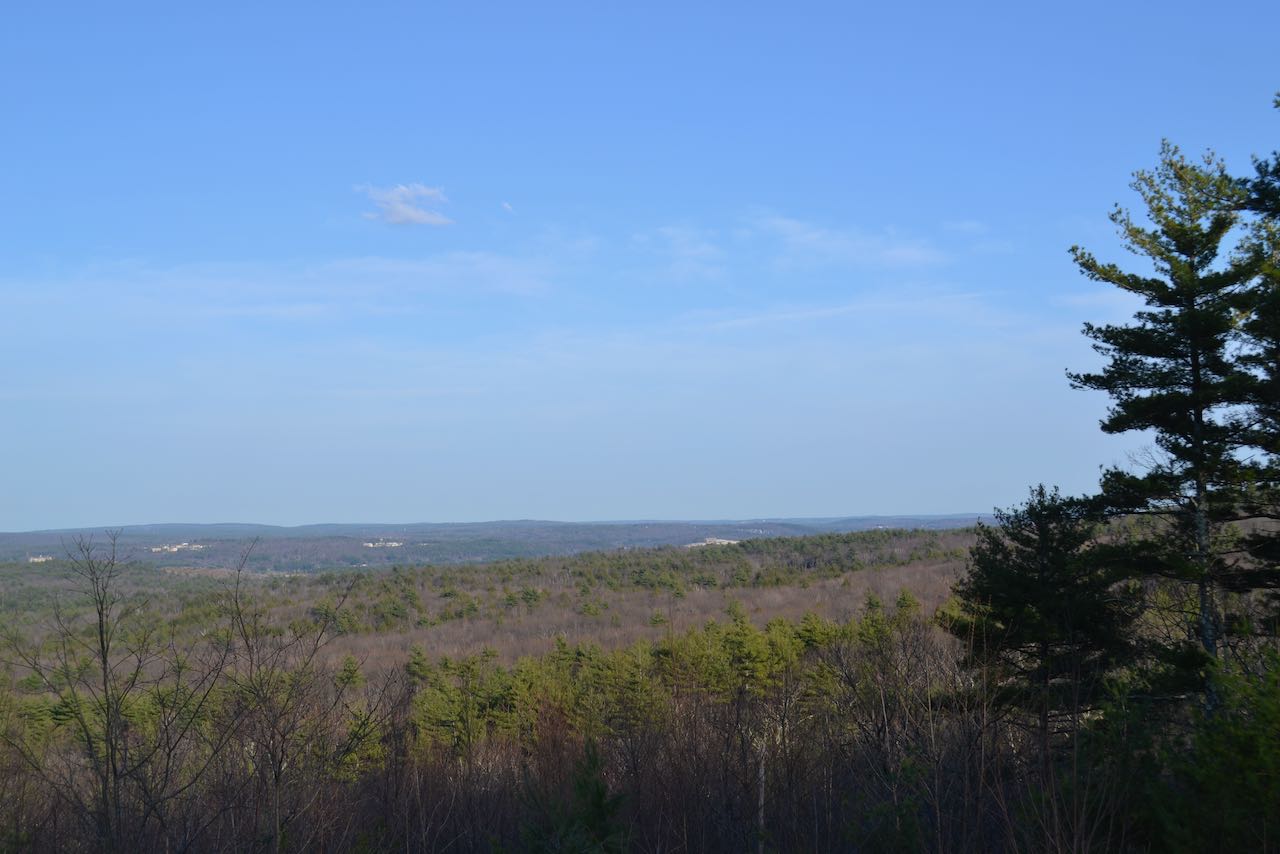
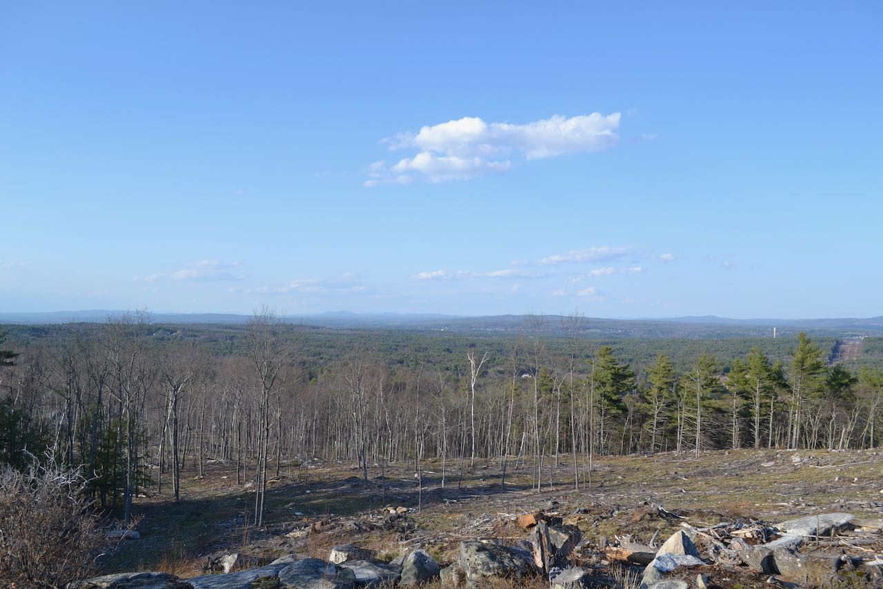
Leaving the kiosk, the trail runs in the vicinity of nearby houses, crosses a muddy spot on bog bridges, and transitions into a wide dirt path ascending gently. After 0.2 miles, an opening appears on the left where you can gaze out toward distant Mt. Monadnock (L) and Crotched Mountain (R). The trail soon proceeds straight across a snowmobile corridor, then reaches a junction in 0.1 miles. Bear left onto Walter's Way at this point to make a loop around the summit. Quickly reach the edge of the clearing and continue out into the open. Several trails run in proximity through this clearing. The trail runs along the top of a steep slope, which overlooks further clearing below. The highest point is reached at the far end of the clearing, 0.2 miles from the junction, after making a sharp right bend. You'll find a bench and a signpost marking a three-way trail junction.
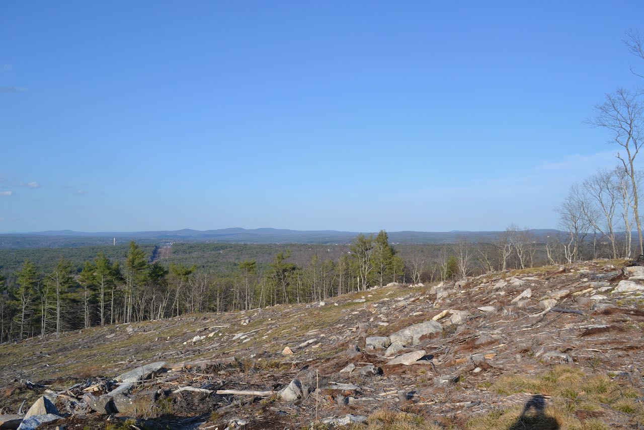
The clearing wraps over the side of the hill and opens up a sweeping panorama to the north. Over on the left side of the view, you can see the nearby slopes of Picked Hill, highest point in the town of Bow. Due north, on clear days, you can see the southern profile of the distant White Mountains. A closer group of mountains over to the right and more visible is the Belknap Range. Off to the northeast by itself is Catamount Mountain, and further over is the grouping of McCoy, Fort, and Nottingham Mountains. To the east, the very tips of the Pawtuckaway Mountains can be seen, along with Hall Mountain in Bear Brook State Park. Continue straight around the outside edge of the clearing on the Great Hill Loop Trail. The trail soon exits the clearing and drops into the trees, then rises to a lower shoulder of the hill after 0.1 miles, also cleared out, which provides a clearer view of the flat expanse to the east. From here, the trail turns and heads back below the clearing to close the loop. In 0.1 miles, continue straight as Nancy's Trail diverges left and the other fork of Great Hill Loop goes right. You are now back on Hamilton's Path. Less than 0.1 miles further, you will arrive back at the junction with Walter's Way. You can now follow Hamilton's Path the way you came.
Printable directions page